Coming to the County to ride bikes?Better get a map.There are so many maps of the County out there nowadays: the Arts Trail Map, the Barn Quilt Map, the Fishing Map, the Wine Country Map... none of those are particularly good for cyclists. But over here at the Bloomfield Bicycle Company we make a local cycling map (a thumbnail below). It includes most of the local attractions on those other maps, but is more topographically accurate and includes which roads are busiest, where the hills are, detailed town and Millennium Trail maps as well as locally vetted cycling routes (with descriptions and distances!)for all. We wanted to make the kind of map we'd like to find when we visited somewhere to go riding. And it's FREE!
|
 |
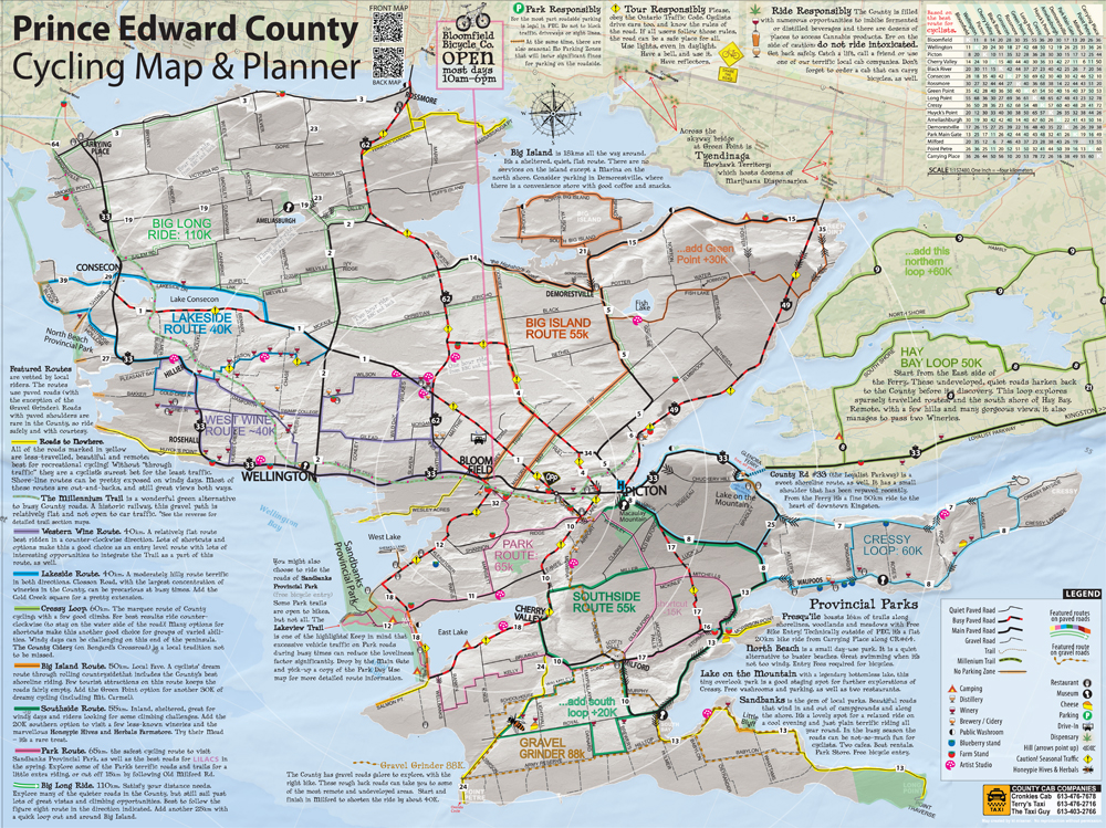
The paper map is 24" x 18". You can download a scalable (but not really printable) version of it here. The PDF map does well on a tablet or a desktop; making planning so much easier! There is a copy of the that you may find of use on your phone here. (but it's not great, even with a larger smartphone) There are simplified GPS tracks of of these routes on RidewithGPS *if that kind of thing is your bag.
For best results, use all the resources you have available: maps AND GPS! Drop on by and the bike-smart staff at the BBC will be happy to tell you where to go. Because we love to tell people where to go.
The back of our map has some good info on it as well, including local town maps, Millennium Trail detail and lots of local riding information and tips. Download a scalable PDF here (best on a tablet or destop). A phone friendly version of the quite large PDF below can be viewed here (I hope)
Drop us an This email address is being protected from spambots. You need JavaScript enabled to view it. and we'll chuck one in the mail for you.
The back of the map 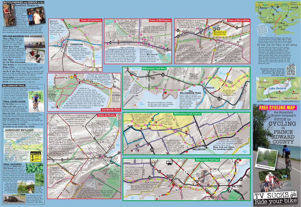
PEC Mountain Biking: a long twisted tale
The only public mountainbiking in the County is at Macaulay Mountain Conservation Area just outside of Picton on County Rd #8. (Behind Birdhouse City).
The trails are generally not dry enough for cycling until after the spring thaw (middle of May-ish) and should not be ridden for 24 hours after rainfall in Picton. The Conservation Authority has created "Exploration Routes" marked by painted trees through the woods.
In times passed the Bloomfield Bicycle Club maintained and monitored a 25km trail system from 1998 through to 2017. During the pandemic, new management at Quinte Conservation undertook significant trail modifications without consultation with the Club, or any other local user groups. They did not file a trail plan, or discuss with former staff the locations of significant wildlife or plants. They blocked many trails by dropping trees, and put up "trail closed" signs in the middle of heavily used trails on on blind corners: so do be careful.
The Bloomfield Bicycle Club, in conjunction with other local users and doctors and stakeholders attempted to stop this destruction of trails, Hemlock trees and endangered habitats, to no avail. That all being said, there are still trails at Macaulay, and they are still fun. They are not well maintained.
A PDF of our Mountainbiker's Map is available for download here as well.
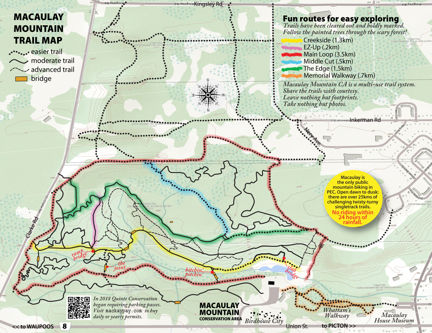
At the end of the summer 2018 season Quinte Conservation Authority also began a program charging for parking in the Conservation Parking Lots throughout their catchment area. Visit Mackaypay.com to purchase your daily or yearly pass. Often the Macaulay Mountain (Birdhouse City) parking lot can be crowded. The parking lot at the end of York St, beside the Macaulay House Museum, is shaded, free and has direct access to Whattam's Walkway, and makes a fine alternative.
Further Afield
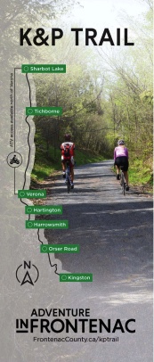
For those of you looking for trails and routes further afield from PEC : the Advermap Land 'O Lakes recreational cycling map is online!